
Watts Bar Lake Winter Drawdown: What Lower Water Means for Your Shoreline
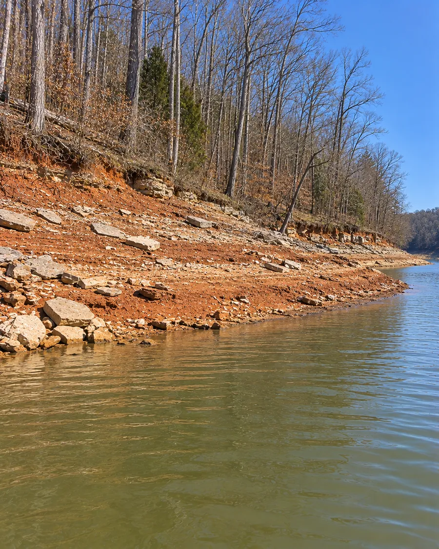
Every year starting November 1, TVA lowers Watts Bar Lake from its summer range of 740 to 741 feet toward a winter minimum of 735 feet. For a lakefront owner, that five-to-six-foot drawdown uncovers a band of bank, old riprap and dock footing that stays underwater from spring through fall. This page explains the numbers TVA publishes, why the lake comes down, what the exposed shoreline can tell you, how fixed and floating docks sit through the winter, and the TVA rules that are tied to the drawdown, along with the ones that aren't.
The numbers TVA publishes
Watts Bar Lake levels
- Typical summer range
- 740 to 741 feet
- Minimum winter level
- 735 feet, held to keep enough depth for navigation
- Drawdown begins
- November 1, the same day as Fort Loudoun upstream
- Size of the drop
- About 5 to 6 feet from summer range to winter minimum (our arithmetic)
- Refill
- Main-river reservoirs are kept lower until late April or early May
- Flood storage
- 379,000 acre-feet
TVA's pages give the start date and the winter minimum. TVA's drawdown page also says reservoirs are typically lowered at least to their winter flood-guide levels by January 1 each year, though it doesn't list Watts Bar's flood-guide elevation, and that during flood season levels may fall several feet below flood-guide levels to meet other operating objectives. Check the current level before planning anything around the waterline.
Why TVA lowers the lake
Watts Bar is one of TVA's flood-storage reservoirs. TVA lowers those reservoirs ahead of the winter flood season to make room for runoff from winter storms. Watts Bar's minimum winter level of 735 feet exists for a second reason: navigation. The dam has a lock that moves barges between Watts Bar and Chickamauga, and the reservoir carries a navigation channel up the Clinch and Emory rivers.
Because it's a main-river reservoir, Watts Bar moves less than TVA's tributary lakes. TVA says main-river reservoirs don't fluctuate as much because of their design and navigation needs, and that they fill more quickly. Five to six feet is still enough to change how a shoreline looks for half the year.
What the lower water shows on a bank
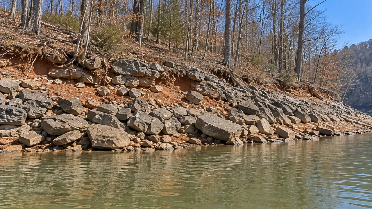
The band of bank that spends summer underwater is the part you can't inspect from the yard in July. With the lake down, walk your shoreline and look at:
- the toe of the bank, where it meets the lakebed, and whether it has been scoured out,
- how deep any hollow under the turf really goes,
- old riprap: whether stone has slumped down the slope, thinned out, or left soil showing between rocks,
- the base of any wall, and whether the stone in front of the footer is still there,
- dock pilings, anchors and the shore end of the walkway, and
- anything that has fallen in and is now sitting on the exposed bottom.
Take photos with something for scale, then take the same shots after the lake refills. TVA's 26a application requires photos, and a pair that shows the bank at both levels gives TVA, and any contractor, a far better picture than one summer snapshot.
Does the drawdown change what you can do?
Some, but less than people assume. Here is what TVA's rules actually tie to the drawdown, and what they don't:
- Riprap and stabilization: TVA's stabilization section, 18 CFR 1304.208, sets no season. We found no TVA statement that winter is the time for riprap. Your TVA permit and any Tennessee permit coverage can carry their own conditions, so read them.
- Boat channel digging: TVA's rule on excavating individual boat channels on TVA residential access shoreland says the work must be done during the reservoir drawdown, when the reservoir bottom is exposed and dry (1304.207(g)). TVA approves such channels only when it finds no other practicable way to get enough water depth and the work wouldn't substantially affect sensitive resources (1304.207(a)).
- Boat ramps and marine railways: a concrete boat ramp or marine railway in the access corridor must be built during the reservoir drawdown (1304.205(a)).
- Floating structures in crowded coves: in congested areas, TVA may add permit conditions requiring floating structures to be dry-docked once the reservoir reaches a set drawdown elevation (1304.205(g)).
- Any work on TVA property, winter or summer, needs TVA's written approval first, including trimming or clearing vegetation on the exposed bank.
So the drawdown is a good time to look, measure and photograph, and to have someone walk the shoreline with you. Whether work happens then depends on your permit, access and the contractor's schedule. TVA aims for 100 to 120 days to issue minor permits, so an application filed in late summer may not be decided until the lake is already coming down.
Docks and lifts through the winter
On Watts Bar, TVA requires fixed piers and docks to have deck elevations at least 24 inches above full summer pool (1304.204(d)). Five TVA lakes, Pickwick, Wilson, Wheeler, Guntersville and Nickajack, use 18 inches instead. TVA defines full summer pool as the elevation it plans to fill each reservoir to, and suggests confirming it with TVA when you apply. If it falls in the 740-to-741-foot range TVA lists as typical, a fixed deck built at the 24-inch minimum would stand roughly seven to eight feet above the water at the 735-foot winter minimum. That's our arithmetic, not a TVA figure.
A floating dock rides down with the water, so its walkway to shore changes angle as the lake drops. Winter is when you can see how a dock's walkway, anchoring and shore connection handle the full range. If you're adding a boat lift, ask the installer how it will work with the lake at 741 feet and at 735. Dock repair and boat lifts cover the permits.
Exposed lakebed on the lower lake
On the lower part of the reservoir and up the Clinch River arm, the Department of Energy reports contaminated sediment in the old river and creek channels, generally buried under 8 to 32 inches of clean sediment. DOE says that contamination is controlled partly by restricting dredging, and that dredging permit requests there are reviewed by TVA, DOE and TDEC. If you're thinking of using low water to dig out a slip or channel on that part of the lake, start with TVA. More on the Clinch River arm and lower lake page.
Drawdown questions
When does Watts Bar Lake go down?
TVA begins the seasonal drawdown on Watts Bar and Fort Loudoun on November 1.
How low does it go?
TVA sets the minimum winter level at 735 feet, held for navigation. The typical summer range is 740 to 741 feet, so the drop is about five to six feet.
When does the water come back up?
TVA keeps main-river reservoirs like Watts Bar lower until the end of the flood season, in late April or early May.
Can I dig out my boat slip while the water is down?
Only with TVA approval. TVA approves individual boat channels only when there's no practicable alternative, and requires the digging to happen while the bottom is exposed and dry. On the lower lake and Clinch arm, dredging also gets DOE and TDEC review.
Can I clean up brush on the exposed bank?
Not on TVA property without TVA's written approval. TVA says trimming or removing any vegetation on its land always needs written approval.
How this site helps
If the drawdown has shown you a bank or dock problem, call (865) 445-5366 or send a request. We'll connect you with one independent local contractor who works on Watts Bar Lake to take a look and give you a written price. The referral is free.
Related pages
Sources
- TVA, understanding the drawdown
- TVA, Watts Bar Reservoir and dam facts
- 18 CFR Part 1304, TVA's Section 26a rules (full text on tva.com)
- TVA, Section 26a application instructions and fees
- TVA, shoreline construction permit FAQ
- U.S. Department of Energy, Lower Watts Bar Reservoir and Clinch River/Poplar Creek
Did the drawdown show you a problem?
Call or send a request to reach one independent local contractor who works on Watts Bar Lake. The referral is free.